Is Waimea Always This Rainy In The Summer?

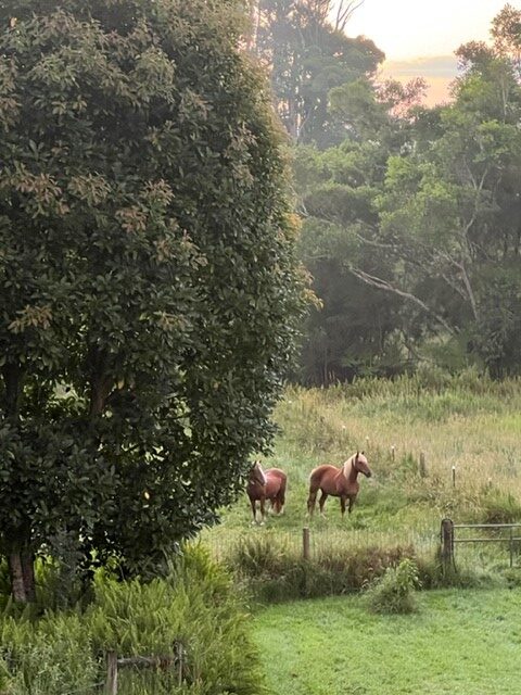
If you’ve been in Waimea this summer wondering why it feels wetter than the “dry season” you keep hearing about on the news, you’re not imagining things. The disconnect comes down to where the weather forecasters are standing when they say it.

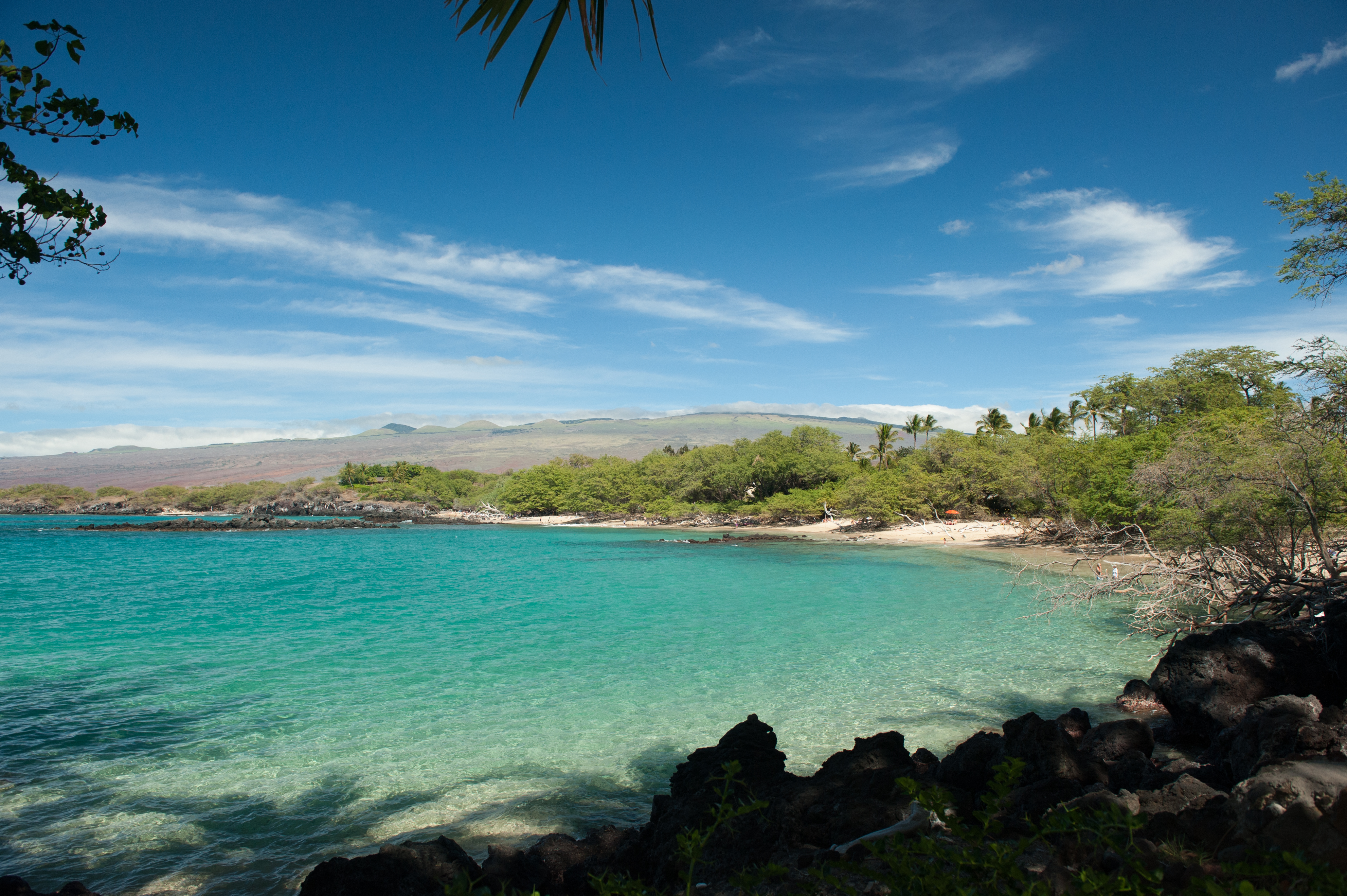
“Dry season” and “wet season” are useful shorthand, but they’re really describing Honolulu and the resort coasts — Waikiki, Kona, Kohala. Those are leeward places, sheltered from the trade winds, and summer really is their dry stretch. But Waimea sits up in the hills between the wet Hamakua Coast and the dry Kona side, and our weather doesn’t follow the Honolulu script.

Here’s the mechanism. Hawaii’s trade winds blow out of the northeast most of the year, but they’re actually strongest and most consistent in summer — running upward of 80-90% of the time from May through October. Those winds carry moisture off the open Pacific, and when they hit the windward slopes and volcanoes, the air gets pushed up, cools, and drops that moisture as rain. Windward areas — which includes us — tend to get more clouds and more showers in summer, not fewer, because the trades that deliver the moisture are blowing harder and more often. Winter is when the trades ease up and a different pattern, Kona weather, has more of a chance to move in from the south. That’s when rain shifts to the normally-dry leeward side and Waimea gets more of its clear, cool, blue-sky stretches.

So the “dry season” label isn’t wrong, exactly — it’s just leeward-centric. If you live on the windward side of any of the main islands, summer is usually your wetter half of the year, and winter your drier one. It’s basically the reverse of what the tourist brochures tell you.

I want to be careful not to overstate this. Hawaii’s wind and rain patterns are notoriously fickle, and this general rule doesn’t hold every year or every week. We’ve had winters with unusual rain and summers that stayed surprisingly dry, and Kona weather can show up any time and flip everything on its head for a few days. If you want to actually geek out on why a particular week is behaving the way it is, Drew Davis, a meteorologist with Hawaii News Now, puts out daily forecast videos on YouTube that go into real depth on what the trade wind pattern is doing island by island — worth a follow if you like understanding the “why” and not just the “will I need an umbrella.”

But generally speaking, if you live in Waimea, you already know the rhythm: we put up with the gray skies of summer, and we live for the clear, crisp days of winter. It’s the opposite of how most of the state’s population experiences the seasons, and it’s one of those things that makes sense the minute you understand which side of the mountain you’re standing on.

Vog: What Every Big Island Resident and Buyer Needs to Know

June 2026

I spent the better part of last week thinking I was coming down with something. Low-grade headache, scratchy throat, a little congestion, mild fatigue. My daughter suggested it might be vog rather than a virus. I think she was right — since it comes and goes and never gets much more severe.

That experience prompted this post. Vog is one of those facts of Big Island life that people considering a move here often don’t fully appreciate until they’re living with it.

What is Vog?

Vog — short for volcanic smog — is air pollution created when sulfur dioxide gas released by Kīlauea reacts with oxygen, moisture, dust, and sunlight to form a hazy mix of gas and fine particles. Unlike wildfire smoke or car exhaust it’s entirely natural, but that doesn’t make it harmless.

Kīlauea is one of the most active volcanoes in the world and has been continuously venting sulfur dioxide for decades. Even when the summit eruption is in a pause between episodes volcanic gas emissions can remain elevated and vog can continue to affect air quality across the island. Right now we’re in midsts of a two-year long eruption, and the emissions have been elevated the entire time. That may sound surprising, since the volcano is not constantly fountaining, but there is a difference between an eruption and episodes. The current eruption started in December of 2024, and there have been periods of fountaining (episodes) and pauses, but as far as volcanologists are concerned, we’re still in the same eruption. During that entire time, the amount of sulfur dioxide being emitted has been very elevated, compared to periods between eruptions. During pauses in the current eruption, gas emission rates have ranged between 1,000 and 5,000 tonnes per day, compared to the 120 tonnes per day between eruptions.

Where Does Vog Go?

This is where it gets interesting — and why the forecast maps (linked below) are so useful. Vog doesn’t affect the entire island equally. Where it goes depends almost entirely on wind direction and speed.

On typical trade wind days, the northeast winds carry vog from Kīlauea’s summit southwest and around the mountains, where it collects on the leeward Kona side of the island. Kona and South Kona bear the brunt on most days.

When trade winds slacken or shift — most commonly in winter, but it can happen anytime — the pattern reverses. Vog can blanket the summit region, Volcano Village, Kaʻū, and parts of east Hawaii including Hilo. On those days Waimea and the upper slopes of Mauna Kea often sit above or upwind of the densest vog layer — but not always. Wind direction and speed vary daily, and individual sensitivity to vog also varies from person to person. Vog ebbs and flows rather than following any simple long-term trend — but right now, conditions are more active than the recent baseline.

Symptoms to Watch For

Residents and visitors commonly report headaches, breathing difficulties, increased susceptibility to respiratory ailments, irritated eyes, sore throats, flu-like symptoms, and general fatigue from vog exposure, with some people also reporting fatigue or dizziness.

People most likely to experience negative health effects from vog include those with asthma or other respiratory conditions, as well as new or expectant mothers. Children and older adults are also generally more sensitive.

For most healthy people symptoms are mild and temporary — more annoying than dangerous, as I experience myself. For people with respiratory conditions, vog can be more serious.

What This Means for Buyers

Vog is a fact of life on the Big Island. It is worth factoring into your decision about where to live:

  • The leeward Kona side experiences the highest vog levels on most days
  • Waimea and upper elevations are often spared the worst of it but are not immune
  • Properties at higher elevation and on the windward side generally have better air quality on typical trade wind days
  • If you or a family member has respiratory sensitivities, discuss vog with your doctor before committing to a location

Resources for Tracking Vog

Conditions change quickly — sometimes hour by hour. Here are the best resources for current and forecast vog conditions:

  • Vog Forecast Map — University of Hawaii forecast maps showing predicted vog movement across the island. This is the one I find most useful.
  • Hawaii Interagency Vog Dashboard — real-time air quality data, vog forecasts, health information and protection advice. A comprehensive resource maintained by a partnership of state, federal and university agencies.
  • Hawaii DOH Air Quality Map — current and historical air quality data from monitoring stations across the islands
  • Hawaii SO2 Index — current SO2 levels across Hawaii Island with color-coded advisory levels
  • AirNow — federal air quality index based on real-time particle monitoring
  • PurpleAir — crowd-sourced air quality sensor network with good coverage across Hawaii Island
  • USGS Hawaiian Volcano Observatory — current Kīlauea eruption updates and volcanic gas information

Living With Vog

Vog is one of the realities of living on an actively volcanic island in the middle of the Pacific. Like the earthquakes, the fire risk, and the cost of shipping, it’s something to understand clearly before you commit — and to manage sensibly once you’re here.

Judy S. Howard, Esq. is a Realtor Broker with COMPASS in Waimea, Hawaii, and a licensed Hawaii attorney with over 30 years of experience. She can be reached at judy@livinginwaimea.com or 808-885-5588.

This post is intended to share general information and personal experience, not medical advice. If you are experiencing symptoms you believe may be related to vog — or any respiratory or health symptoms — please consult a healthcare provider, particularly if you have asthma or another respiratory condition.


Earthquakes on the Big Island: What the May 2026 Quake Tells Us

June 8, 2026

On May 22nd the earth moved, a little. A couple of boards leaning against my barn wall fell over. That was the extent of the damage at my place on the wet side of Waimea. South Kona was a different story entirely.

A magnitude 6.0 earthquake struck at 9:46pm near Honaunau-Napoopoo on the west flank of Mauna Loa, at a depth of about 14 miles. No tsunami was generated. Hawaii County Civil Defense reported rockslides onto roadways, multiple road closures, power outages, and structures shifting on their foundations. The damage was significant — while fortunately no injuries were life-threatening, some homes were badly damaged and residents were calling plumbers overnight to deal with broken water connections. This was the largest earthquake on the Big Island since the magnitude 6.9 earthquake in 2018.

What Made This Earthquake Unusual

Many earthquakes on the Big Island are associated with volcanic activity — magma movement, the south flank of Kilauea shifting, or the décollement, a nearly flat fault system underlying much of the island that separates volcanic rock from the oceanic crust below.

This one was different. The earthquake occurred at a depth of 22.6 kilometers, meaning it nucleated in the mantle — too deep to be related to shallow magma movement beneath Hualālai or Mauna Loa.

So what caused it? Scientists point to what’s called the flexural stress model — think of it like a diving board bending under the weight of a diver. The Hawaiian Islands are extraordinarily heavy volcanic structures sitting on the oceanic plate. That weight causes the plate to bend, creating compression in the mantle beneath. Over time, faults form in the mantle in response to that compression, and when stress builds sufficiently, they slip — producing earthquakes like this one.

A similar earthquake — magnitude 5.5 — occurred in almost exactly the same location on May 8, 1991, with the same reverse faulting mechanism. This type of earthquake can happen here regardless of what the volcanoes are doing.

For a detailed scientific explanation, the team at Temblor.net has written an excellent analysis: Magnitude 6.0 earthquake strikes the Big Island of Hawai’i

Earthquakes Can Happen Anywhere on the Island

This is the important point for anyone living here or considering a move. Earthquakes are not confined to the volcanic zones. I have lived through earthquakes that crumpled bridges and sent my mother’s china crashing to the floor despite the raised rims on her shelves in closed cupboards. The May 22nd earthquake was centered in South Kona — but it was felt across the entire island and as far away as Maui and Oahu.

Damage depends heavily on proximity to the epicenter, depth of the quake, soil conditions, and building construction. Waimea came through with minimal damage this time. That won’t always be the case.

What This Means for Buyers

Earthquake risk is a real consideration when buying property anywhere on the Big Island. Here is what I recommend as part of due diligence:

  • Check the building’s construction — older unreinforced masonry structures are most vulnerable. More concerning on the Big Island are homes sitting on concrete blocks, some without any strapping connecting the structure to the foundation. These are significantly more vulnerable in a major earthquake than properly anchored wood frame construction. If you’re buying an older home, have a contractor or structural engineer assess how the structure is connected to its foundation before you close. This is not standard in a typical home inspection and may require a specific request.
  • Check your insurance coverage — the State of Hawaii’s own Department of Commerce and Consumer Affairs states clearly that most homeowners policies will not protect you from earthquake loss. A separate earthquake policy is worth considering. Be aware that earthquake policies typically carry high deductibles of 10-25% of your home’s value — for a $400,000 home that means paying $40,000 to $100,000 out of pocket before insurance kicks in. Talk to your insurance agent about your options during due diligence.
  • Water catchment and plumbing — if your property has a water tank, make sure the plumbing connections are properly secured. This was a common source of damage in the May 22nd quake.
  • Secure your belongings — raised rims on shelves help but aren’t foolproof. Securing heavy furniture, water heaters, and valuables is basic earthquake preparedness that many people overlook until after the fact.
  • Know your evacuation routes — particularly if you’re near the coast, where a large submarine earthquake could generate a tsunami.

For current damage reports from South Kona read the coverage at Big Island Now and Hawaii News Now.

Living With Earthquakes

Longtime Big Island residents learn to take earthquakes in stride. Most are small — barely noticeable. Occasionally one reminds you that you live on a volcanically and seismically active island in the middle of the Pacific Ocean. That’s part of what makes this place extraordinary. It is also part of what requires clear eyes and realistic expectations when you decide to make it your home.

Judy S. Howard, Esq. is a Realtor Broker with COMPASS in Waimea, Hawaii, and a licensed Hawaii attorney with over 30 years of experience. She can be reached at judy@livinginwaimea.com or 808-885-5588.


Hawaii Fires and Rain: What Every Big Island Resident and Buyer Needs to Know


Updated May 2026. Originally published August 2021.

Brush fires have always been part of life on the Big Island. But the stakes have changed. What was once an occasional nuisance has become one of the most serious considerations for anyone living in or moving to Hawaii.

The Wake-Up Call: Lahaina

In August 2023 a firestorm decimated the historic town of Lahaina on Maui, killing over 100 people and destroying more than 2,000 structures. It was one of the deadliest wildfires in American history. For those of us on the Big Island, it was a reminder that Hawaii’s wildfire risk is real, serious, and not limited to the dry leeward coast. Several fires broke out at the same time in the Kawaihae area, but no lives were lost.

The Mana Road Fire

The most dramatic illustration of Waimea’s own wildfire risk came in late July and early August 2021, when the Mana Road fire scorched more than 42,000 acres of mostly grassland above Waimea — largely on Parker Ranch — making it one of the largest wildland fires in recorded Hawaii history.

The fire started on arid Parker Ranch land south of the eastern outskirts of Waimea town. Very strong and gusty winds from the northeast drove it rapidly along dry pasture land on the northern slope of Mauna Kea. Delays in obtaining equipment and coordinating response allowed the fire to spread up the western flank of Mauna Kea, jump Old Saddle Road, and cross the road between Waimea and Waikoloa. Residents of Pu’ukapu Hawaiian Homestead and Waiki’i Ranch were ordered to evacuate, and the fire eventually triggered a third evacuation order for Waikoloa Village.

Two ranch houses were destroyed south of Waimea town, but homes in Waikoloa and Waiki’i suffered nothing worse than a heavy coat of smoke and ash. Parker Ranch temporarily lost a significant portion of its grazing land. Even though I live no more than six miles from where the fire started, I never smelled smoke — a testament to how dramatically conditions vary across just a few miles of terrain here.

There have been many smaller brush fires over the years. This is not a one-time event. It is an ongoing reality of life in this part of the island.

Waimea and the Dry Side

Brush fires are common on the dry side of Waimea and the leeward coast. The pattern is familiar to longtime residents: lush grass grows after a good rain, and if it is not grazed down it eventually dries and becomes excellent fuel. Waimea, Waikoloa, and Kawaihae are all identified as high-risk wildfire zones on the Big Island.

Fires can start in surprising ways. A few years ago a fire broke out not far from Waimea Middle School — believed to have started when a catalytic converter on a car that had pulled over on the road ignited the dry grass. There was property damage but no loss of life. We were fortunate.

In recent years the National Weather Service has issued red flag warnings for critical fire weather conditions covering North Kohala, South Kohala, and interior portions of the Big Island, with wind gusts up to 50 mph and humidity as low as 40%. Hawaiian Electric has begun monitoring conditions and may shut off power lines in communities with high wildfire exposure — a direct response to the role downed power lines played in the Lahaina disaster.

The Wet Side Is Not Immune

People assume that the windward side of the island — the Hamakua Coast, the wet side of Waimea — is safe from fire. It is not.

In 2021 a fire burned 1,400 acres near Paauilo on the Hamakua Coast. The fuel source was the abandoned eucalyptus plantations that dot that landscape. When the sugar plantations closed, someone decided to plant eucalyptus for pulp. The trees were planted too close together to be mechanically harvested, the project was abandoned, and brush grew up between the trees. It apparently didn’t take much to light the whole place on fire. Those plantations are still there.

Where I Chose to Live — and Why

I deliberately chose the wet side of Waimea. Having practiced water law in Colorado I like the idea of plentiful water at all times — and I like to sleep at night. Worrying about fire keeps me up. I may have overdone it slightly in terms of rainfall, but I’d rather have too much rain than too little.

I have clients who want to live on the dry side regardless of the fire risk. I understand the draw — ocean views with Maui in the background, warmer temperatures, the absence of mud. When I want any of those things I drive to the Kohala Coast for a brief visit. I’m always glad to get back to the cooler, greener, calmer world on the wet side.

What This Means for Buyers

Wildfire risk is now a mandatory consideration when buying property anywhere on the Big Island — not just the obvious leeward areas. Here is what I recommend as part of any due diligence process:

  • Check the property’s wildfire risk zone — the Northwest Hawaii Community Wildfire Protection Plan identifies specific communities at risk including Waimea, Kohala Ranch, Waikoloa, and many others
  • Ask about defensible space around the property
  • Investigate fire insurance availability and cost before making an offer — as I discuss in my post on What You Need to Know Before Moving to the Big Island, insurance has become significantly more expensive and harder to obtain in fire-prone areas
  • Know your evacuation routes

The Bigger Picture

Hawaii’s wildfire problem is fundamentally a land management problem. Experts point to invasive fire-prone grasses that have overtaken vast areas of the islands as the primary fuel source for most wildfires. When I was a child it was routine to see black skies and flakes of burned sugar cane — fields were burned after harvest before a new crop was planted. We need to find modern equivalents of that kind of land management, or we need to stop building in fire-prone areas. Preferably both.

The beauty of the Big Island is inseparable from its landscapes. Protecting those landscapes — and the people who live among them — requires taking fire risk seriously.

Judy S. Howard, Esq. is a Realtor Broker with COMPASS in Waimea, Hawaii, and a licensed Hawaii attorney with over 30 years of experience. She can be reached at judy@livinginwaimea.com or 808-885-5588.